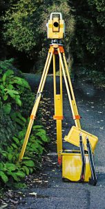
At Johnson & Associates we know that accurate land surveying is the cornerstone of any successful project. Accuracy enables our clients to optimize their project timeline and budget. From design to completion, our focus is on getting accurate, precise land surveying results.
Our experienced team of land surveyors utilize the latest in automated land surveying technology and state-of-the-art electronic equipment for accuracy you can depend on. Our survey crews strictly abide by the Standards of practice for Land Surveying in the State of Alabama, The Alabama Department of Transportation (ALDOT) Surveying and Mapping Manual, ALTA/ACSM standards, NGS procedures for geodetic surveys, and other state, federal, and municipal regulations. Our abilities include extensive experience using GPS and ground-based radar imaging systems to produce accurate information for planning communities, institutions, and government instillations.
Johnson & Associates is proud to have been awarded an agreement with the ALDOT for Surveying Services Statewide, as well as Transportation Support Services Statewide, and Construction Engineering and Inspection (CE&I) Services.
Land Surveying Services
- Boundary Surveys
- Topographic Surveys
- GPS and Geodetic Surveys
- ALTA / ACSM Surveys
- As-Built Surveys
- Construction Staking
- Elevation Certificates
- Utility Route Surveys
- Stockpile Volume Surveys
- 3D Laser Imaging
- Route Surveys
- Control Surveys
- Forensic Surveys
- GIS Data Collection


